Cotswold Way
The Cotswold Way is a 100-mile (160 km) footpath from Chipping Campden to Bath. It was inaugurated as a National Trail in 2007, and has created a number of new rights of ways.
Understand
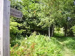
The Cotswold Way is a marked trail on gently undulating ground in central England. The route runs near many villages, so you should be able to find a B&B or hotel to spend the night (but book in advance), and maybe a pub for the odd lunchtime treat.
Budget accommodation is scarce near the trail, and wild camping is not permitted. Expect to spend around £100 or more per person per day (2022 prices).
The Cheltenham Gold Cup horse race takes place in mid-March every year, most of the beds near the way are likely to be booked up months in advance at this time.
Prepare
Luggage transfers
If you want to walk light, you can arrange for a company to transfer your bag from one hotel to the next. These services generally only run from mid-March to late October. In 2022, per day transfer charges start at £10 for one bag, with extra bags at a reduced price.
Get in
Go
| Point | Coordinates | OS Grid Ref | Notes |
|---|---|---|---|
| Start | 51.375°N 2.359°W | ST751640 | 🌍 Bath. |
| 51.426°N 2.401°W | ST721697 | 🌍 Battle of Lansdowne. | |
| 51.531°N 2.352°W | ST756815 | 🌍 Old Sodbury. | |
| Somerset Monument | 51.587°N 2.329°W | ST772876 | 🌍 Hawkesbury, Gloucestershire. |
| 51.635°N 2.355°W | ST755929 | 🌍 Wotton-under-Edge. | |
| Tyndale Monument | 51.658°N 2.372°W | ST743956 | 🌍 Tyndale Monument at North Nibley. |
| 51.678°N 2.350°W | ST758978 | 🌍 Dursley. | |
| 51.745°N 2.256°W | SO823052 | 🌍 Stroud. | |
| 51.786°N 2.193°W | SO867098 | 🌍 Painswick. | |
| 51.817°N 2.151°W | SO896132 | 🌍 Cranham. | |
| 51.864°N 2.074°W | SO949184 | 🌍 Leckhampton. | |
| Highest point | 51.919°N 2.007°W | SO996245 | 🌍 Cleeve Hill. |
| Sudeley Castle | 51.947°N 1.956°W | SP031276 | 🌍 Sudeley Castle. |
| 51.957°N 1.969°W | SP022287 | 🌍 Winchcombe. | |
| Hailes Abbey | 51.968°N 1.928°W | SP050299 | 🌍 Hailes Abbey. |
| 51.991°N 1.913°W | SP060326 | 🌍 Stanway. | |
| Broadway Tower | 52.024°N 1.835°W | SP113362 | 🌍 Broadway Tower. |
| Broadway Hill | 52.035°N 1.855°W | SP100374 | 🌍 Broadway. |
| End | 52.053°N 1.773°W | SP156395 | 🌍 Chipping Campden. |
Stay safe
Go next
External links
- Cotswold Way Official National Trail Cotswold Way website
- Cotswold Way route relation on OpenStreetMap
- Map of the Cotswold Way indicated in 2 mile sections
- Wall Street Journal article
- The Walking Englishman